
Up in the north-west, Stockport Council have got some interesting new tricks on their website. As some of the Lib Dem councillors up there explain:
Stockport Council has launched a great new service, allowing us all to see a huge amount of information overlaid on a map of the borough.
———
Put in your road or postcode from the front page of the Stockport website and find out a host of useful information from your bin collection days and councillors to your local schools, health centre, leisure centre, park, library, optician, pharmacy, doctor, dentist, hospital, planning applications and more.
———-
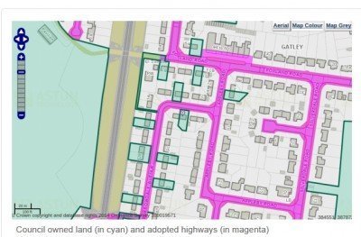
There?s a mapping function covering the whole borough. You can find out almost anything. The map below shows land the Council owns along with adopted highways (i.e. pavement and road the council is responsible for maintaining) together.
You can find out more here.
We wonder how expensive this is. If it was cheap, it would be useful to have this down here.
